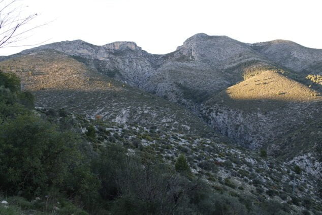
The Barranc de l'Infern makes up one of the most attractive and recurring hiking routes in the Marina Alta for mountain enthusiasts. It is located between the Vall d'Ebo and the Vall de Laguar and there are different routes to explore it or get to it. It is a gorge with geological and archaeological interest through which the Girona River passes, although it is normally dry. Next we will see one of its routes, which begins in the Vall d'Ebo.

Next you have an index with all the points that we are going to deal with.
- 1.
- 2.
- 2.1.
- 2.2.
- 2.3.
- 2.4.
Technical data
The distance of the Barranc de l'Infern hiking route from the Vall d'Ebo is 13,5 kilometers. The estimated duration to travel it is 5 30 hours and minutes, depending on the rest times and the practice you have in hiking. For this reason, it is understood that the difficulty of the route is high.
Route layout

The start of the route, as indicated by Wikiloc, is located in the Vall d'Ebo, a town to which it is reached through the CV-712 from Pego. As soon as you enter the municipality, once you have crossed the Girona or Ebo river, you can find several signs indicating all the existing routes in the area.
Girona or Ebo River
The tour starts at exit east from Vall d'Ebo following the PR-CV 58 heading towards Tormos. In this first section you travel along a track, which passes through the area's treatment plant, and when the path forks it is necessary to take the one on the left. Once the track is finished, you cross the bed of the Girona River. The most common thing is to find the river without water, however, to carry out the route the hiker must make sure that this is the case. For this reason, it is not recommended to take the path during rainy seasons.

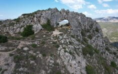
Avenc Wide
After the riverbed, the reference point will be a corral, which must be skirted and the climb up the adjoining path begins. Before reaching another track, you have to cross the CV-712 road, where you will soon find the Avenc Wide.
Pista de les Juvees and Trekking Cathedral
After passing through the Avenc, you must go back down the track towards the same CV-712 road. In this section the descent to the Barranc de l'Infern begins. For this reason, once you have crossed the road, follow the path to the left until you find the court of les Juvees. This track leads to the corral de la Carrasca.

The route continues along the track PR-CV 43, where will they be found Juvees d'Enmig. In this area is located the indicative of route PR-CV 147, known as the Hiking Cathedral. A circular route that runs through the Barranc de l'Infern itself and the more than 6.800 stone steps built by the Moors who populated the area. To continue, it is necessary to take this path as a way to go down to the Barranc.
Reinos Fountain
Following the route is the Reinos Fountain, one of the points marked by Wikiloc for reference. From here you descend towards the ravine. In this case, the PR-CV 147 continues until Juvees de Dalt, however, on the current route, in this section it is necessary to return to Vall d'Ebo. In this way, the channel is resumed through which to reach the starting point.
Finally, to get out of the ravine you take the Gili track, where there is a spring, although its water is not drinkable. From this point you can follow the track that returns to the Vall d'Ebo to conclude the route.