The stormy Celia arrives, probably, in one of the most anticipated weeks of the year. Baptized by the Instituto Português do Mar e da Atmosfera (IPMA), it will be the third with the greatest impact on the peninsula this 2022 and the first of the so-called climatological spring.

Dust in suspension and rain of 'blood'
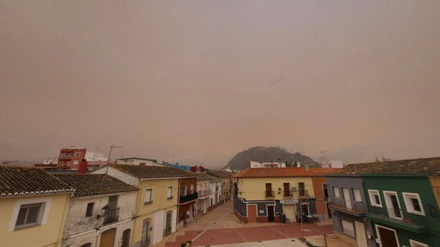
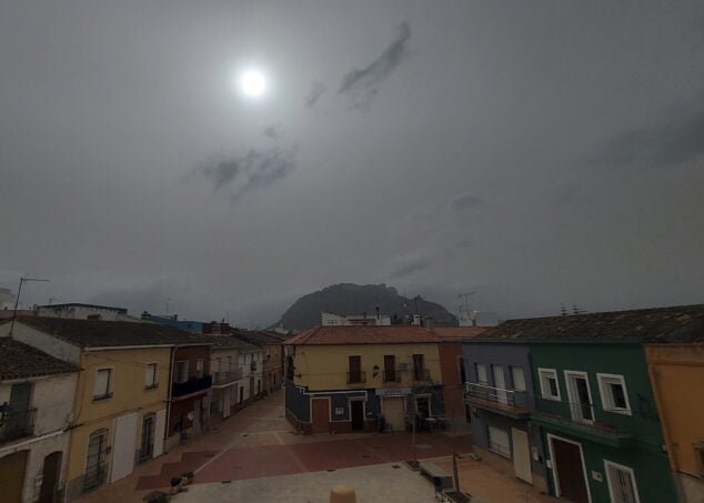
Yesterday morning started gray with some light rains that stopped during the first hours of the day. But, it was from the second half of the day when the expected dust in suspension of Saharan origin. In this way, the sky of the Marina Alta became considerably cloudy and began to turn orange, a natural episode more typical of summer.
Suspended particles consequently cause a very harmful air quality. The WHO determines a concentration of PM10 particles greater than 50 µg/m3 to qualify as adversity in quality, and levels in the next few hours may exceed 200 µg/m3. What some historical records mean.
The UA Climatology Laboratory predicts that the particles remain in the region until Thursday. So, if the most intense rains of the storm begin on Wednesday, the mixture of both phenomena will result in showers of 'blood' or mud.
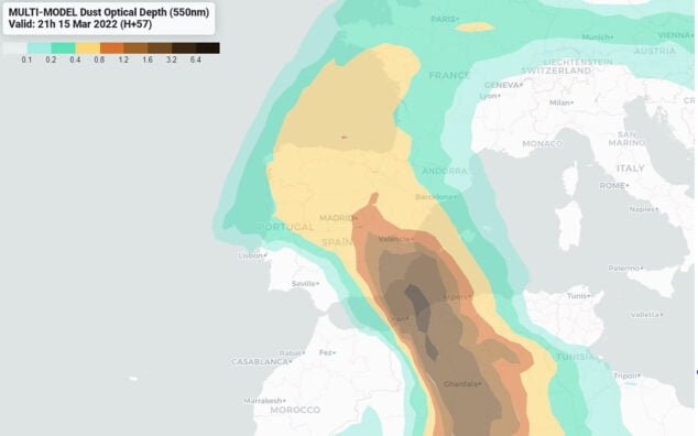
In some points of the Marina Alta, the drops that could have fallen on Monday afternoon have already left the surfaces dirty, with an intense yellowish tone. However, the suspended particles will move away as the advance of the storm progresses to the east peninsular, more specifically in the direction of the region. This advance will correspond to the second part of the storm in the territory.

Cold drop
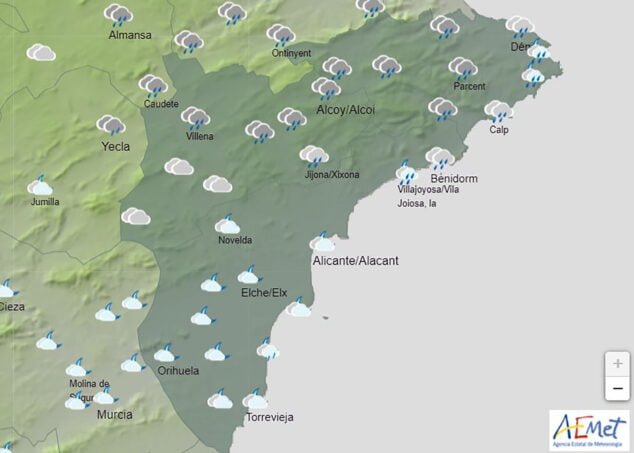
The State Meteorological Agency yesterday activated the yellow alert for coastal storm, which continues until early Wednesday morning. Waves of up to 3 meters are thus expected on the north coast of Alicante.
In today's update, Tuesday, the Agency has also activated the yellow alert due to rain throughout the day on Thursday. So, the rainfall will start from noon on Wednesday.

For its part, the UA Climatology Laboratory points out the formation of a DANA, which will affect the north coast of Alicante, specifically the Marina Alta. For this reason, accumulations of more than 200 l/m2 are forecast.
The forecast map gets worse as the hours and days go by. At the same time as the most intense and important days of the Fallas 2022 arrive. In the region, the monuments of Dénia, Calp and Pego will burn when wet.
AEMET marks the map in the region with rainfall everything that reaches its available forecast, that is, from the middle of the week until the morning of next Monday, March 21. But, although the rains affect the region, the forecasts indicate that the most torrential storms will be more likely in the interior.
-
 AEMET forecast for Wednesday, March 16

-
AEMET forecast Thursday afternoon

-
Forecast for Friday (AEMET)

-
Forecast map for Saturday, March 19, 2022 (AEMET)
Images
-
Arrival of Saharan dust in the Marina Alta
-
Els Poblets and Segària in the background

-
Clouds and dust on Tuesday

-
Suspended dust laden environment

-
dust particles in the air

-
Dark sky in the region

-
mud on cars

-
Effect of rain with mud

-
Effects of rains of 'blood'

-
mud after rain